Spatial Environmental Intelligence
GIS analysis,
GIS analysis,
remote sensing,
environmental
mapping for
planning and
conservation.
Based in Exeter, Devon.


What we do
We analyse spatial data to deliver science-driven insights for environmental planning, biodiversity assessment, land management, and investment decisions.
Get in touch
Contact Us
Tell us about your project and we’ll outline how we can help.
Our Services
GIS analysis, remote sensing, environmental mapping, and spatial data science.
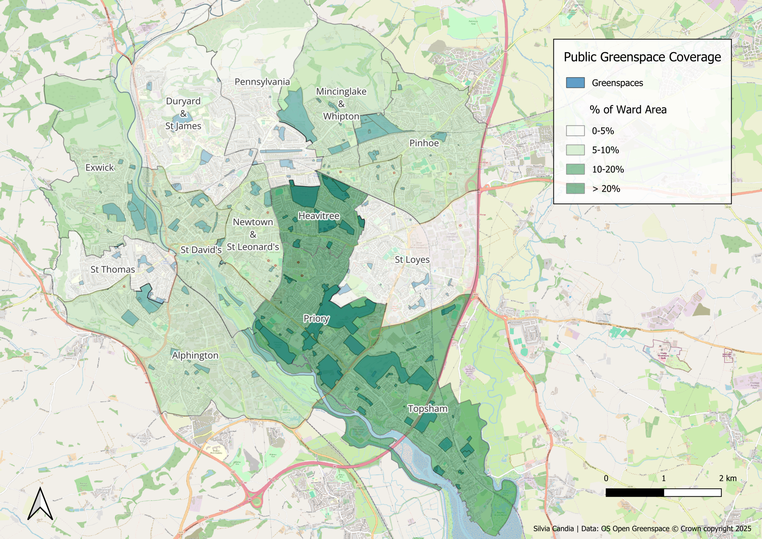
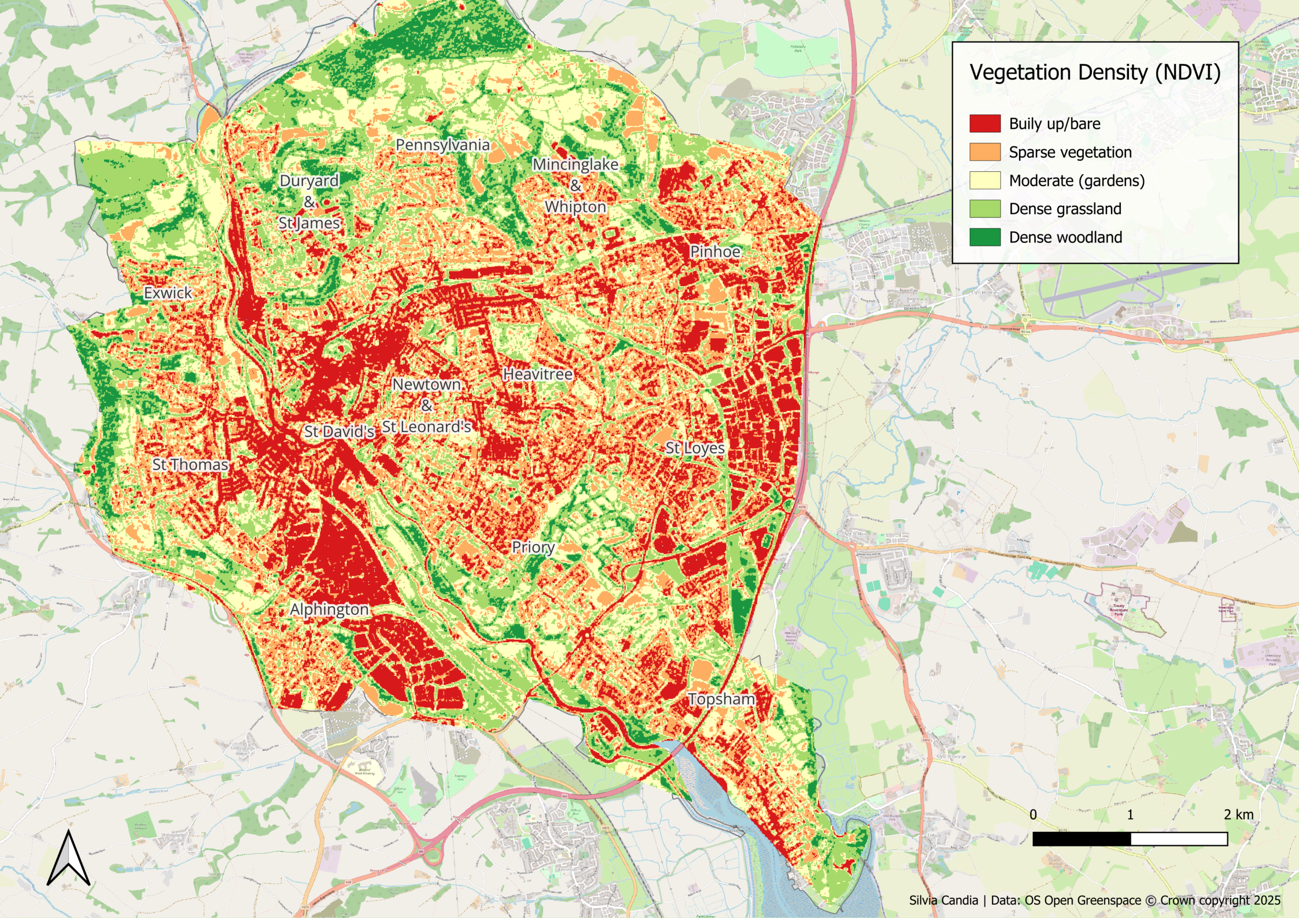
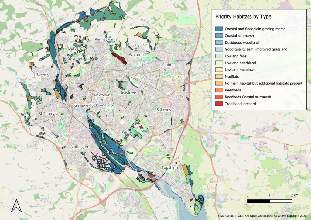
Featured Project: Exeter Biodiversity Access Analysis
A ward-level study of greenspace equity, habitat value, and ecological connectivity across Exeter’s 13 wards.